Get the Best Solution for Geographical Information System (GIS) and Remote Sensing (RS)
Get accurate GIS mapping and remote sensing services tailored to your needs. Make smarter decisions with reliable spatial data, satellite imagery, and expert analysis for various industries.

Our GIS & RS Services
We provide expert GIS & RS mapping and analysis services, supporting urban planning, climate monitoring, resource management, disaster risk assessment, sustainability, and remote sensing to deliver smart, data-driven geospatial solutions.
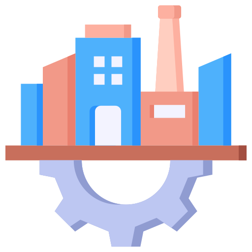
Urban Intelligence & Smart City Design
Designing innovative, sustainable urban environments using smart technology to enhance infrastructure, community living, and long-term city growth with good strategies.
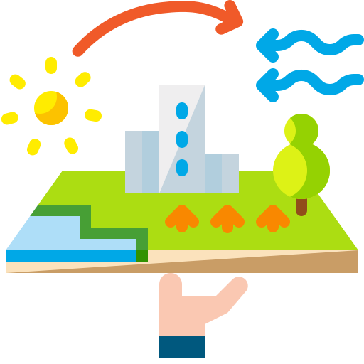
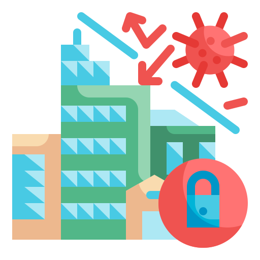
Environmental Monitoring & Climate Adaptation
Delivering smart solutions in environmental monitoring & Climate Change tracking Climate change, reducing risk, and guiding eco-conscious planning decisions. Spatial Nexus
Natural Resource Intelligence
We help governments, businesses, and organizations develop sustainable Natural Resource Management plans that preserve ecosystems and ensure future environmental resilience.
Disaster Resilience & Geo-Hazard Mapping
From risk identification to emergency response, we deliver comprehensive disaster management services that enhance preparedness, reduce vulnerability, and support recovery for all sectors.
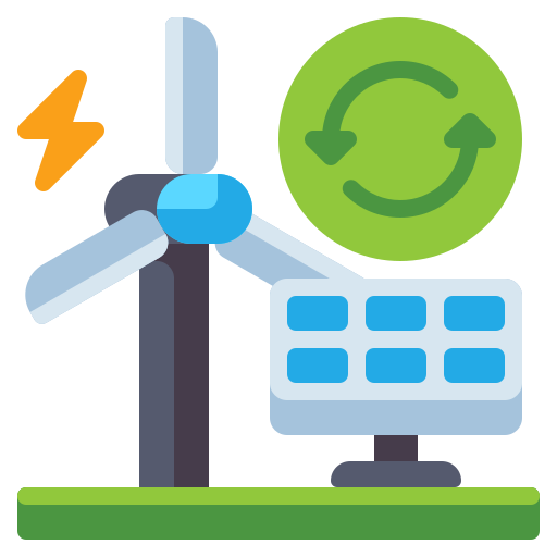
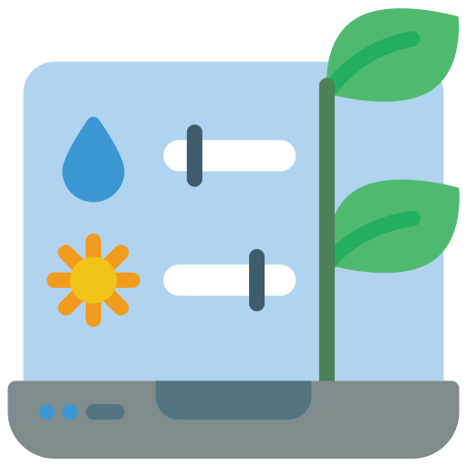
Renewable Energy & Sustainability
Driving sustainability through innovative renewable energy systems, designed to minimize impact, maximize efficiency, and ensure a resilient future for generations.
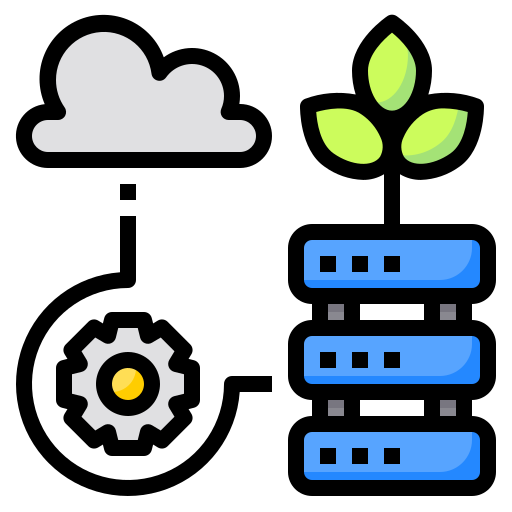
Advanced Remote Sensing & Satellite Analytics
Our solutions drive sustainable development by harnessing renewable energy sources, cutting emissions, and creating long-term value for communities and the planet.
Looking for Professional Approach and Quality GIS &RS Services ?
Looking for a professional approach and top-quality GIS & RS services? We deliver precise, reliable geospatial solutions tailored to your needs, empowering smarter decisions for urban planning, the environment, and more.
What We Provide?
Delivering reliable GIS-RS mapping and analysis services for planning, monitoring, and assessment across urban, environmental, and energy sectors with a focus on accuracy, sustainability, and informed action.

Urban Planning & Smart Cities
Using GIS-RS mapping and analytics, we empower smart city planning with tools for managing growth, optimizing transportation, analyzing population trends, and enhancing infrastructure. Our solutions support data-driven urban design that improves livability, resilience, and resource efficiency for communities, governments, and urban developers.
Environmental Monitoring & Climate Change
We deliver environmental monitoring and climate change analysis through advanced GIS tools. Our services support evidence-based policy development, climate adaptation planning, and resource protection by visualizing trends, tracking changes, and modeling environmental impact over time.


Natural Resource Management
We provide GIS & RS based solutions for natural resource management, including land use planning, forestry, water resources, and biodiversity mapping. Our services support sustainable development, efficient resource utilization, and informed environmental decisions through accurate spatial data and analysis.
Disaster Management & Risk Assessment
We deliver accurate GIS-RS risk assessments for disaster preparedness, helping identify hazards, assess community exposure, and guide emergency response. Our spatial analysis tools strengthen decision-making to reduce disaster impact and safeguard lives, assets, and infrastructure.


Renewable Energy & Sustainability
We provide GIS-RS solutions to support renewable energy planning and sustainability goals. From site suitability analysis to environmental impact mapping, our services help identify optimal locations, reduce risks, and promote clean energy development for a greener, more resilient future.
Remote Sensing & Satellite Image Analysis
We provide remote sensing and satellite image analysis services to extract accurate geospatial data for land use, vegetation, environmental monitoring, and urban growth. Our high-resolution imagery solutions support decision-making, project planning, and resource management across multiple industries using advanced image processing and spatial analysis techniques.

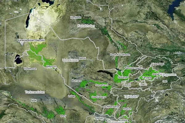
The Use of Data in GIS & RS Services
Data utilization is essential to GIS & RS services since it enables the production of precise, detailed maps and the analysis of a variety of spatial and geographic data.
Mapping Solution
A flawless visual representation of the data is provided by GIS & RS surveys. An outstanding illustration of a web-based GIS-RS mapping tool used for navigation is Google Maps.
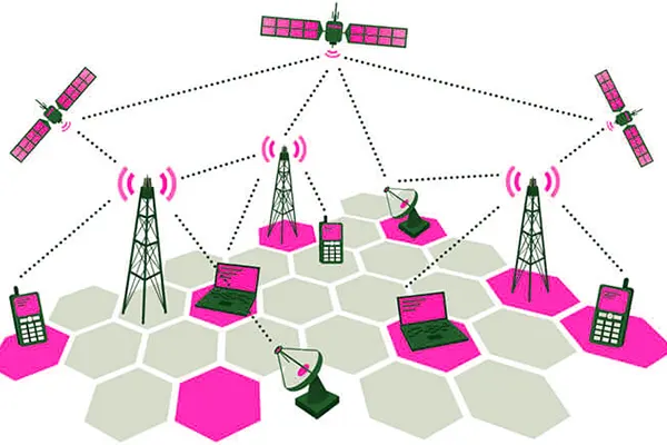
Telecom and Network Services
GIS-RS data is used by organizations to simplify difficult network design, optimization, planning, and maintenance tasks and improve telecom processes.
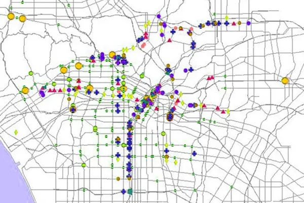
Accident Analysis and Hot Spot Analysis
Accident sites can be located using GIS-RS data, and road networks are frequently improved by utilizing data intelligence to increase traffic safety.
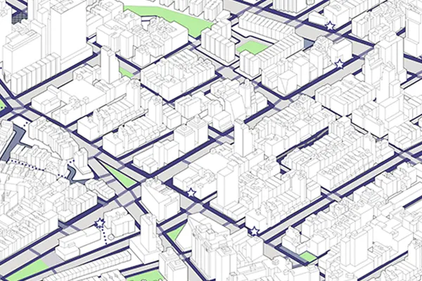
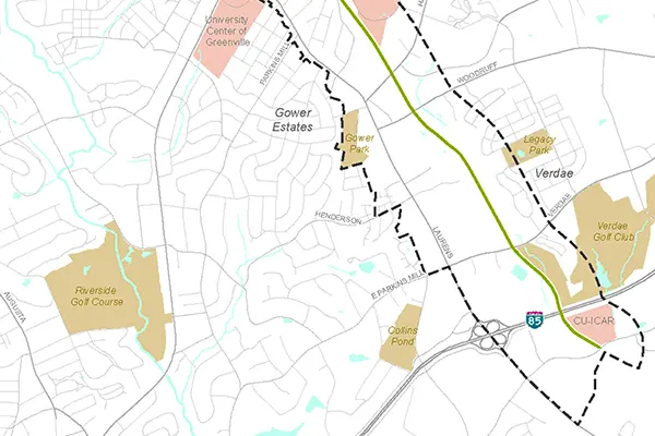
Urban Planning
Urban growth and, thus, the direction of expansion are analyzed by GIS-RS data. Identify fresh locations for development while taking into account elements required for effective construction.
Transportation Planning
GIS_RS data assists in managing transportation issues. Using gathered environmental and current data, businesses plan new road or rail lines.
Environmental Impact Analysis
GIS-RS applications assists in conservation of natural resources and protecting the environment by assessing the magnitude of human impact on the environment.
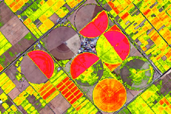
Agricultural Mapping
GIS-RS survey data contributes to the development of more productive and efficient agricultural methods, as well as the sophisticated analysis of soil data that results in increased food output.
Disaster Management and Mitigation
An effective GIS-RS system safeguards the environment and is designed to help with any potential risk and catastrophe management.
Navigation
GIS-RS data is used in web-based navigation maps to provide the general public with helpful information. Web maps are frequently updated based on GIS data.
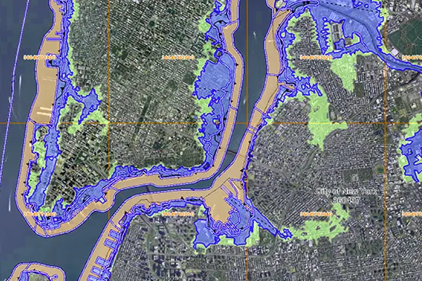
Flood Damage estimation
Governments map flood-prone areas using GIS data, and they can access information to plan relief operations for the impacted areas.
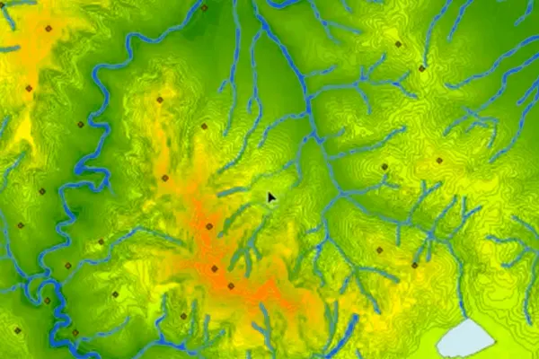
Natural Resources Management
GIS-RS provides a powerful set of tools for collecting, storing, analyzing, and visualizing geographically referenced data to manage and analyze natural resources.
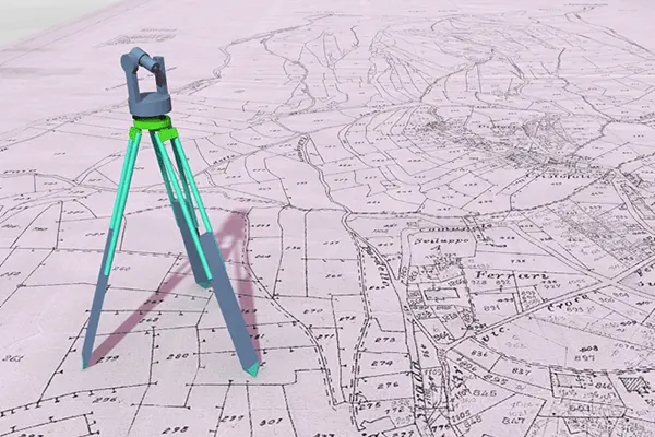
Surveying
GIS-RS surveying entails determining the locations of things on Earth and integrating GNSS and GIS systems to estimate areas and create digital maps.
Navigation
GIS-RS data is used in web-based navigation maps to provide the general public with helpful information. Web maps are frequently updated based on GIS data.
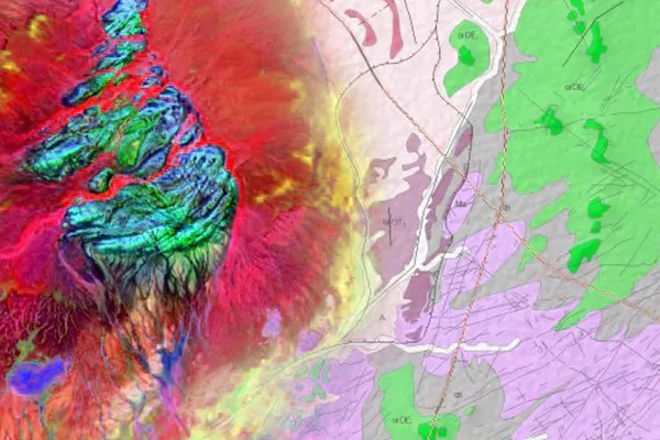
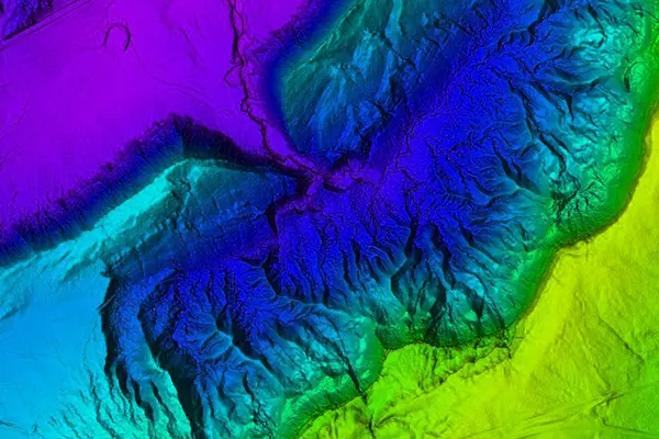
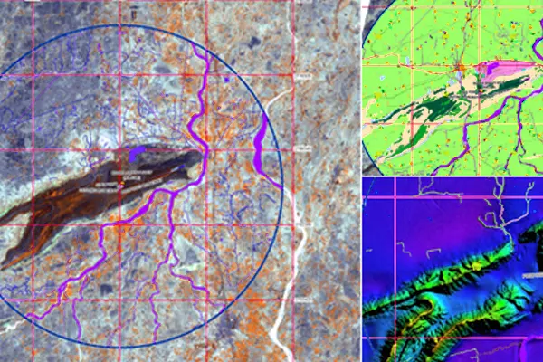
Geology
Geologists analyze seismic data, conduct soil studies, and create 3D visualizations of geographical characteristics using GIS data. It is also sometimes used to examine the properties of rocks.
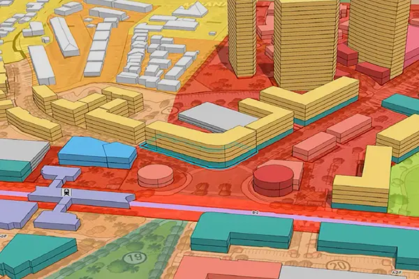
Planning and Community Development
GIS-RS data enables us to understand and address global issues. There are numerous cutting-edge uses within the planning industry for GIS technology, which is developing quickly.
Irrigation Water Management
Crop productivity in a specific area is directly influenced by the water resources available. GIS data can identify important crops and calculate production using effective methods for the geographical and temporal domains.
Geospatial Data Used in Various Industries
To increase high levels of productivity, Spatial Nexus provides Point Cloud Classification services for various industries.