

Replicate & Enhance U.S. National Park Service Map Using ArcGIS Pro
Project Overview
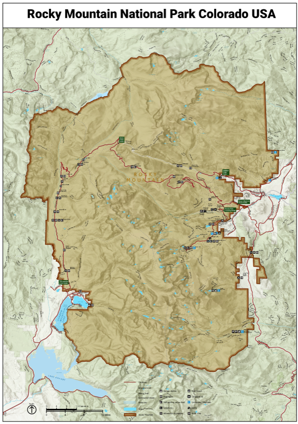
High-quality cartographic design is essential for effective communication in environmental management and tourism. In this project, Spatial Nexus replicated and enhanced maps developed by the National Park Service (NPS) using ArcGIS Pro to create a more refined, user-centric mapping solution.
The objective was to improve map readability, visual hierarchy, and spatial clarity while ensuring consistency with modern GIS cartographic standards. The enhanced maps were designed to better support park visitors, planners, and decision-makers by delivering clear and intuitive geographic insights.
The Challenge
Traditional park maps, while informative, often face limitations that impact usability and effectiveness:
- Inconsistent symbology and color schemes reducing visual clarity
- Overcrowded labeling leading to poor readability
- Limited optimization for multi-scale viewing (print vs digital)
- Lack of standardized cartographic hierarchy for key features
- Difficulty in interpreting terrain, trails, and service locations
These challenges reduce the overall effectiveness of maps for navigation, planning, and visitor experience.
Our Solution
Spatial Nexus applied a data-driven cartographic design approach to replicate and significantly enhance NPS-style maps:
- Recreated base maps using high-quality spatial data in ArcGIS Pro
- Optimized labeling techniques for clarity and hierarchy
- Applied advanced cartographic principles for better feature differentiation
- Ensured map usability across both digital and print formats
This approach ensured that the final output is not only visually appealing but also functionally superior for real-world use.
The Impact
The project delivered measurable improvements in cartographic quality and usability:
- Enhanced readability and user experience
- Improved interpretation of geographic features and terrain
- Better support for navigation and spatial decision-making
- Increased accessibility for diverse user groups
- Elevated visual standards aligned with modern GIS practices
This solution is highly valuable for environmental agencies, tourism authorities, and geospatial planning organizations.
Technologies & Tools Used
- ArcGIS Pro Cartographic design and spatial data processing
- GIS Data Sources Terrain, trails, and park infrastructure datasets
- Digital Cartography Techniques Visualization and layout optimization
Skills & Capabilities Demonstrated
- Advanced Cartography & Map Design
- GIS Mapping & Spatial Visualization
- Data Visualization & Layout Design
- Symbology & Labeling Optimization
- Spatial Data Structuring (Object-Relational Mapping)
Key Highlights
- Advanced GIS-based cartographic enhancement
- Standardized symbology and color optimization
- Improved labeling and visual hierarchy
- Multi-scale map design (print and digital ready)
- User-focused map usability improvements
Why This Project Matters
As geospatial technologies evolve, high-quality map design becomes critical for:
- Enhancing visitor experience in parks and tourism destinations
- Supporting environmental planning and resource management
- Improving spatial communication for decision-makers
- Standardizing mapping practices across organizations
Spatial Nexus delivers intelligent cartographic solutions that transform complex spatial data into clear, actionable insights.
Looking to Build Advanced GIS Mapping Solutions?
We help organizations design and implement high-impact geospatial and cartographic systems for environmental management, infrastructure, and planning.
Contact Spatial Nexus Geospatial Consultancy to elevate your next GIS mapping project.