Engineering-Grade Spatial Solutions for Next-Generation Urban Environments
In today’s evolving cities, effective planning and smart infrastructure rely heavily on Geographic Information Systems (GIS-RS). Our advanced GIS solutions for Urban Planning & Smart City Development empower planners, architects, and decision-makers to design efficient, sustainable, and well-connected urban spaces. We deliver actionable insights through real-time spatial data, helping municipalities manage land use, zoning, infrastructure, utilities, and population growth. From tracking urban sprawl to optimizing transit routes and monitoring utilities, our tools support intelligent city planning and resource allocation. We also assist with cadastral mapping, smart infrastructure analysis, and environmental assessments, ensuring sustainable urban growth aligned with future demands. Whether you're building a new smart city or upgrading existing infrastructure, our GIS-driven strategies streamline development, reduce planning errors, and improve quality of life. Harness the power of geospatial technology to shape smarter, greener, and more efficient cities for generations to come.
What We Offer in Urban Planning & Smart City Development
We provide intelligent GIS-RS solutions for urban planning, zoning, transport, utilities, and land records to support smart city growth and infrastructure development.
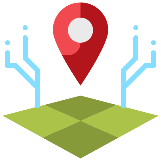
SmartCity GIS
GIS-RS solutions for mapping zoning, utilities, public services, and smart infrastructure to support real-time city management and development.
Urban Expansion Analysis
Identify and analyze urban sprawl trends, land consumption, and city boundary growth using historical and current spatial data.

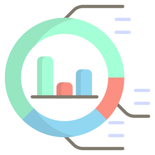
Transportation Network Optimization
Optimize roadways, transit lines, and pedestrian paths for better connectivity, accessibility, and reduced congestion across cities.
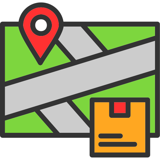
Land Parcel & Cadastral Mapping
Provide detailed parcel maps, land ownership data, and property boundaries to aid real estate, taxation, and planning systems.
Urban Planning and Smart City Mapping Development Services
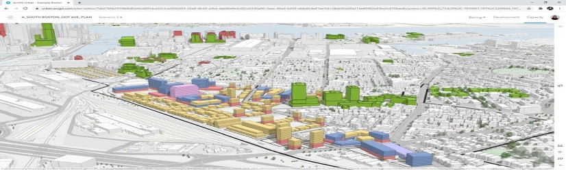
Our Urban Planning and Smart City Mapping services offer powerful GIS-RS solutions to guide sustainable development, efficient land management, and smarter city planning. We help planners and decision-makers map and analyze zoning regulations, infrastructure networks, transportation systems, land ownership, and urban expansion trends. Using satellite imagery, digital elevation models, and census data, we provide deep insights into city dynamics and future needs. Whether it’s designing smart transportation systems, identifying urban growth zones, or integrating utility networks, our services support future-ready solutions. We assist governments and private developers in creating digital twins of cities for advanced simulations and scenario planning. From land-use mapping to public service delivery optimization, we enhance planning efficiency and public safety. With GIS-RS, we enable cities to plan proactively, manage resources effectively, and promote citizen well-being in the digital age.

Various Detailes in Urban Planning & Smart City Development
Our GIS-RS services power smart cities through zoning analysis, infrastructure monitoring, land records management, and transit planning for sustainable, efficient, and future-focused urban development.
SmartCity GIS – Zoning, Utilities, and Infrastructure Mapping.
Our Smart City GIS-RS services centralize city zoning, utilities, and infrastructure into an intelligent mapping platform. This enables real-time monitoring of water, power, and communication systems while supporting smart decisions on service delivery and infrastructure upgrades. We integrate IoT data and geospatial layers to provide a digital twin of your city enhancing governance, citizen services, and planning. From managing traffic lights to mapping green spaces and public assets, our Smart City GIS empowers municipalities to streamline urban operations, improve sustainability, and build truly connected environments.
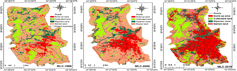
Urban Expansion Analysis – Monitoring Urban Sprawl and Land use
Urban Expansion Analysis tracks changes in land cover, built-up areas, and sprawl patterns over time. Using high-resolution satellite imagery, we help planners assess population pressure, identify illegal developments, and guide zoning decisions. Our GIS-RS tools evaluate environmental impact, infrastructure stress, and future development zones enabling sustainable urban growth strategies. This service supports informed policymaking by visualizing growth corridors, preserving green zones, and balancing economic development with livability and environmental protection.
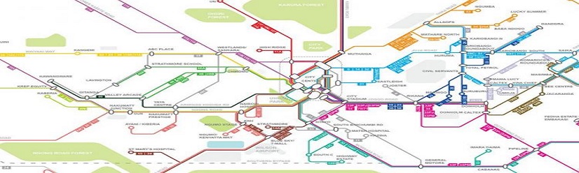
Transportation Network Optimization – Road, Transit, and Pedestrian Mapping.
Our GIS-RS based Transportation Network Optimization identifies bottlenecks, plans efficient public transit routes, and improves pedestrian and bicycle connectivity. We model current and future traffic flows, optimize road hierarchies, and support multimodal transport systems. This helps reduce congestion, improve commute times, and promote sustainable mobility. With real-time data integration, we also support dynamic traffic control and route planning. The result is smarter, greener, and more accessible urban mobility for residents, businesses, and visitors alike.
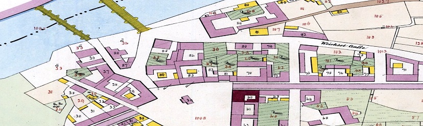
Land Parcel & Cadastral Mapping – Property Ownership and Boundary Mapping.
We provide accurate, georeferenced land parcel and cadastral maps that include ownership details, plot dimensions, and boundaries. Our GIS-RS services enhance land administration, support real estate transactions, improve tax collection, and streamline planning processes. These maps are essential for legal compliance, infrastructure development, and public works projects. By digitizing land records and integrating them with planning layers, we help governments and developers manage land resources transparently and efficiently.
Geospatial Data Used in Various Industries
To increase high levels of productivity, Spatial Nexus provides Point Cloud Classification services for various industries.