

Employment Density Mapping of Dübendorf City Using GIS & Kernel Density Analysis
Project Overview
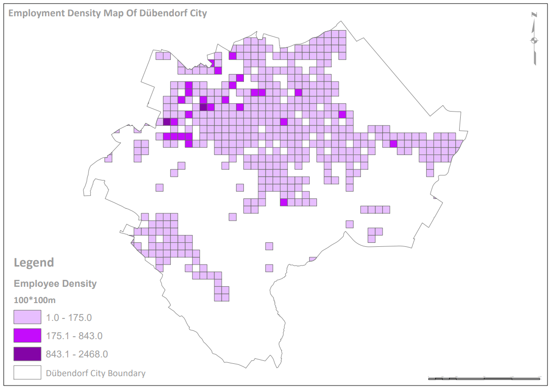
Understanding the spatial distribution of employment is critical for effective urban planning and economic development. In this project, Spatial Nexus developed a comprehensive employment density map for Dübendorf, transforming complex datasets into actionable geospatial insights.
The objective was to analyze and visualize the concentration of employment opportunities across the city, enabling planners, policymakers, and businesses to better understand the local economic landscape. By leveraging advanced GIS techniques, the project delivers a clear and data-driven representation of urban employment patterns.
The Challenge
Urban employment systems involve multiple interconnected factors, making analysis complex. Key challenges included:
- Integrating diverse datasets such as business locations, demographics, and land use
- Identifying meaningful employment clusters within dense urban environments
- Representing employment intensity in an intuitive and visually clear format
- Assessing accessibility to employment hubs via transportation networks
- Delivering insights that support both strategic planning and business decisions
These challenges required a robust geospatial approach to ensure accuracy and usability.
Our Solution
Spatial Nexus implemented a comprehensive GIS-based methodology to address these challenges:
- Collected and integrated spatial data including business locations, industrial zones, and commercial areas
- Incorporated demographic statistics, transportation networks, and land use classifications
- Utilized Kernel Density Estimation (KDE) to visualize employment intensity
- Developed a high-quality map using ArcGIS and QGIS
- Designed a clear, professional cartographic layout for stakeholder communication
This approach ensured a holistic and accurate representation of the city’s employment ecosystem.
The Impact
The project delivered significant value for urban and economic stakeholders:
- Enhanced understanding of the city’s economic structure
- Improved decision-making for urban planning and infrastructure development
- Supported business location strategy and investment planning
- Enabled data-driven policy formulation
- Identified opportunities for future economic growth
This solution is highly applicable for smart city initiatives and regional development planning.
Technologies & Tools Used
- ArcGIS - Spatial analysis and density modeling
- QGIS - Data processing and visualization
- GIS Datasets - Employment, demographics, land use, and transport networks
- Microsoft Office - Reporting and data management
Skills & Capabilities Demonstrated
- GIS & Spatial Analysis
- Kernel Density Estimation (KDE)
- Urban & Economic Analysis
- Cartography & Data Visualization
- Geospatial Data Integration
Key Features of the Employment Density Map
- Hotspots & Clusters
- Accessibility Analysis
- Demographic Integration
- Land Use Overlay
- Future Growth Insights
Why This Project Matters
Employment density is a key indicator of urban growth and economic vitality. This project highlights the importance of:
- Visualizing economic activity through spatial data
- Supporting sustainable urban development
- Enhancing infrastructure and mobility planning
- Enabling data-driven economic strategies
Spatial Nexus delivers intelligent geospatial solutions that bridge the gap between complex data and real-world decision-making.