What Is GeoAI? The Future of Artificial Intelligence in Geospatial Science

What Is GeoAI? The Future of Artificial Intelligence in Geospatial Science

A few years ago, mapping a city's road network from satellite imagery took weeks of manual digitizing. Analysts would sit in front of a screen, tracing roads pixel by pixel, building by building.

Today, an AI model does it in hours.

That's GeoAI in a sentence the collision of artificial intelligence and geospatial science, producing capabilities that would've seemed like science fiction a decade ago. And we're still in the early innings.

If you've read about GIS or remote sensing and wondered where all of this is heading, you're asking exactly the right question. GeoAI is the answer and it's moving fast.

What Is GeoAI?

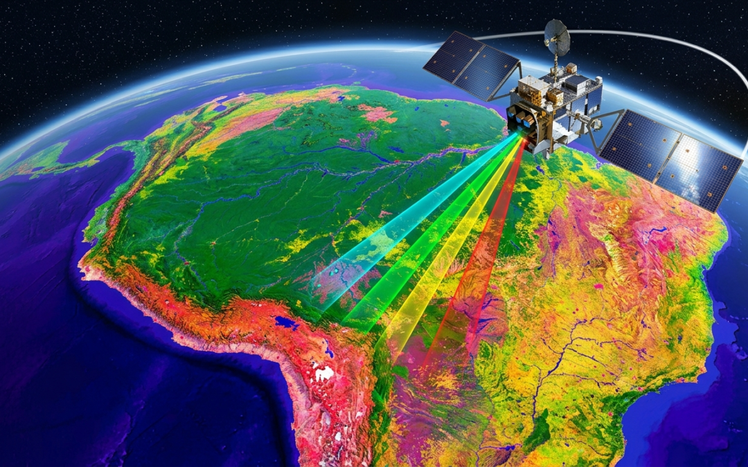
GeoAI short for Geospatial Artificial Intelligence is the application of machine learning, deep learning, and AI techniques to geographic and spatial data. It sits at the intersection of three fields: GIS, remote sensing, and artificial intelligence.

The core idea is straightforward: geographic data is complex, massive, and deeply patterned. AI is exceptionally good at finding patterns in complex, massive datasets. Put them together and you get a system that can do things no human analyst could do alone at a scale and speed that changes what's possible.

Think of it this way. Traditional GIS asks: "What is here?" Remote sensing asks: "What does it look like from above?" GeoAI asks: "What does it mean and what's going to happen next?"

What is GIS? A Complete Beginner's Guide

Real-World GeoAI Applications Already in Use

GeoAI isn't theoretical. It's running in production systems right now, across sectors you'd recognize.

Disaster Response: Faster Than Any Field Team

When disasters strike, speed saves lives. AI in geospatial science has dramatically compressed the time between an event and actionable damage assessment.

After the 2023 Moroccan earthquake, AI models trained on before-and-after satellite imagery automatically detected collapsed structures within 24 hours before most international response teams had even landed. The UN's UNOSAT program uses GeoAI routinely for exactly this kind of rapid mapping.

Climate and Environmental Monitoring

Manually reviewing decades of satellite imagery to track environmental change is a monumental task. GeoAI automates it.

Global Forest Watch, operated by the World Resources Institute, uses machine learning on satellite imagery to detect deforestation alerts in near real time. When illegal logging starts in a protected area, the system flags it within days sometimes before local rangers are even aware. That's spatial data analysis working at a planetary scale.

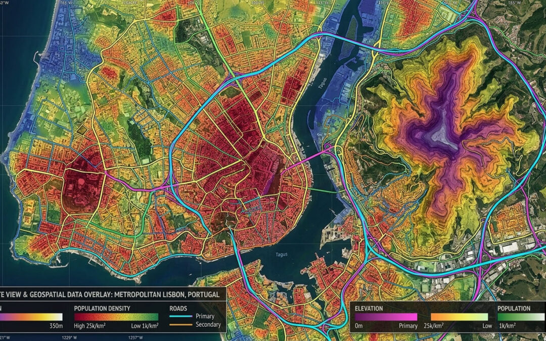
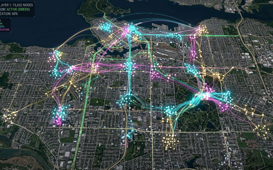
Urban Intelligence and Smart Cities

City planners are using GeoAI to analyze urban growth, model traffic flow, map informal housing, and predict infrastructure failures. Microsoft's Building Footprint project used deep learning to map over 700 million building footprints globally from aerial imagery a dataset that would've taken centuries to produce manually.

Singapore's Virtual Singapore platform combines GeoAI with 3D city modeling to simulate everything from shadow patterns to emergency evacuation routes. It's one of the most sophisticated geospatial AI systems any government has built.

Agriculture: Precision at Scale

Satellite imagery plus AI is transforming how the world grows food. Machine learning GIS models now predict crop yields weeks before harvest, detect pest infestations from subtle spectral changes in vegetation, and optimize irrigation at a field-by-field level.

The startup Descartes Labs processes petabytes of satellite data through AI pipelines to forecast commodity crop production globally information that moves agricultural markets and informs food security policy.

ESRI's GeoAI resources and research hub

The Challenges GeoAI Still Needs to Solve

It's not all breakthroughs and headlines. GeoAI has real limitations worth understanding.

Training data is a bottleneck. AI models need labeled examples to learn from. Creating high-quality labeled geospatial datasets is expensive and time-consuming and models trained in one region often fail to generalize to another.

Explainability is murky. A deep learning model might correctly identify a flood-affected area, but can't always tell you why it made that call. In high-stakes decisions disaster response, infrastructure investment, legal land disputes black-box outputs make stakeholders nervous.

Geographic bias is real. Most training data comes from well-mapped, high-income regions. Models built on North American or European data often underperform in the Global South, precisely where accurate geospatial intelligence is most needed and least available.

These aren't unsolvable problems. But they're honest ones and the GeoAI research community is actively working on all three.

Frequently Asked Questions About GeoAI

How is GeoAI different from traditional GIS?

Traditional GIS tools are rule-based a human defines the analysis logic. GeoAI learns the logic from data. Instead of manually coding "a road looks like this," you show the model thousands of roads and it figures out the pattern itself. GeoAI doesn't replace GIS; it supercharges it.

What skills do you need to work in GeoAI?

A solid GeoAI practitioner typically combines GIS or remote sensing knowledge with Python programming and familiarity with machine learning frameworks like TensorFlow or PyTorch. You don't need all three on day one but building toward that combination opens the most doors in the field.

What software and tools are used in GeoAI?

Common tools include Google Earth Engine (cloud-based geospatial analysis), ArcGIS with AI extensions (ESRI's ecosystem), PyTorch and TensorFlow (deep learning), and open-source libraries like Rasterio, GeoPandas, and TorchGeo. Many workflows also run on cloud platforms like AWS, Google Cloud, or Microsoft Planetary Computer.

Is GeoAI only for large organizations?

Not anymore. The democratization of satellite data (free Sentinel and Landsat archives) and open-source AI tools means individuals and small teams can build meaningful GeoAI pipelines. University research groups, NGOs, and independent developers are publishing serious GeoAI work every month.

Where GeoAI Is Headed

Three things to remember from everything above:

  1. GeoAI combines the spatial intelligence of GIS and remote sensing with the pattern-recognition power of modern AI producing capabilities neither could achieve alone.
  2. It's already operational in disaster response, climate monitoring, agriculture, and urban planning not a future concept.
  3. The field is wide open foundation models, better training datasets, and improved explainability will define the next five years.

Geospatial artificial intelligence is rapidly becoming one of the most consequential applications of AI in the physical world. Not because it's flashy but because the Earth has problems that need solving, and GeoAI is one of the sharpest tools we've built to solve them.

Curious to go deeper? Explore NASA's Prithvi foundation model on Hugging Face, or start experimenting with Google Earth Engine's built-in machine learning tools. The barrier to entry has never been lower and the ceiling has never been higher.

What Is Remote Sensing? How Satellites See the Earth

What Is Remote Sensing? How Satellites See the Earth

Think about the last time you checked a weather forecast. Or watched a news report about melting glaciers. Or used Google Maps in satellite view.

None of that exists without remote sensing.

It's one of those technologies that's everywhere and almost nobody talks about it. Remote sensing is how we watch our planet from above, measure changes we can't see with the naked eye, and make decisions that affect billions of people. And yet most people couldn't define it if you asked them.

That changes today. Here's your plain-English guide to remote sensing, how it works, and why it matters more than you probably realize.

What Is Remote Sensing?

Remote sensing is the science of collecting information about an object or area without physically touching it. In practice, this almost always means using satellites, aircraft, or drones to observe the Earth's surface from a distance.

The "remote" part is key. You're not standing in a field measuring soil moisture with a probe  you're doing it from hundreds of kilometers above, using sensors that detect energy reflected or emitted from the Earth's surface.

Here's a simple way to think about it: your eyes are remote sensors. They detect light reflected off objects without touching them. A satellite works on the same principle  just at a vastly greater scale, picking up wavelengths of energy your eyes can't even see.

Remote sensing is a core component of modern Earth observation, and it feeds data into GIS systems, climate models, agricultural platforms, and disaster response tools around the world.

What is GIS? A Complete Beginner's Guide

How Remote Sensing Works: The Science Behind the Imagery

To understand remote sensing, you need to know one thing: everything emits or reflects energy.

The sun radiates energy across the electromagnetic spectrum from gamma rays all the way to radio waves. When that energy hits the Earth, some is absorbed, some is transmitted, and some is reflected back upward. Sensors on satellites detect that reflected or emitted energy and record it as data.

Active vs. Passive Remote Sensing

There are two main types, and the difference is straightforward:

  • Passive remote sensing the sensor detects natural energy, usually reflected sunlight. Standard optical satellite imagery is passive. It works great in daylight but struggles through clouds or at night.
  • Active remote sensing the sensor emits its own energy pulse and measures what bounces back. Radar and LiDAR are active systems. They work day or night, and can even penetrate cloud cover and forest canopies.

Spectral Bands: Seeing Beyond Visible Light

This is where it gets interesting. Humans see in three color bands red, green, blue. Satellites can see in dozens.

Infrared bands reveal vegetation health healthy plants reflect near-infrared strongly, so a lush field looks bright on an infrared image while a drought-stressed one looks dull. Thermal infrared detects heat, useful for spotting wildfires, tracking urban heat islands, or monitoring industrial activity. Microwave bands penetrate clouds and measure soil moisture or ice thickness.

The ability to see across the electromagnetic spectrum is what makes remote sensing so powerful. You're not just taking a photograph. You're reading the planet's vital signs.

The Satellites Doing the Work

Not all satellites are the same. Different missions are built for different purposes.

Landsat - The Long-Haul Workhorse

NASA and USGS have operated the Landsat program since 1972 the longest continuous record of Earth's surface from space. Landsat imagery has been used to document deforestation in the Amazon, track urban sprawl, and monitor crop changes across entire continents. It's free to access and has been downloaded millions of times by researchers worldwide.

Sentinel - Europe's Earth Watchers

The European Space Agency's Sentinel satellites are workhorses of the Copernicus Earth observation program. Sentinel-2 captures high-resolution optical imagery every 5 days. Sentinel-1 uses radar, making it invaluable for flood mapping and ice monitoring regardless of weather conditions.

Commercial Satellites - The New Players

Companies like Planet Labs, Maxar, and Airbus Defence & Space now operate dense constellations of small satellites. Planet's fleet can image every point on Earth every single day. That daily cadence is transforming industries from commodity trading (tracking cargo ships and crop yields) to national security.

How satellite data is changing precision agriculture

Remote Sensing Applications: Where It Shows Up in Real Life

Remote sensing isn't an academic curiosity. It's operational, and it touches your life in ways you probably don't notice.

Disaster Response and Emergency Management

When a hurricane makes landfall or a wildfire breaks out, remote sensing data is often the first comprehensive picture emergency managers get. Satellites can assess damage across hundreds of square kilometers in hours before ground teams can safely access the area.

After the 2023 earthquake in Turkey and Syria, satellite imagery from Maxar and the Copernicus Emergency Management Service was used to map collapsed buildings and prioritize search-and-rescue operations within days of the disaster.

Agriculture and Food Security

Farmers and governments use satellite imagery to monitor crop health at a field-by-field level. The Normalized Difference Vegetation Index (NDVI) calculated from red and near-infrared bands gives a precise reading of how green and healthy vegetation is. The UN's Food and Agriculture Organization uses this data to forecast harvests and flag food security risks months in advance.

Climate Change Monitoring

Remote sensing is one of our primary tools for tracking climate change. Satellites measure Arctic sea ice extent, glacier retreat, sea surface temperatures, and atmospheric CO₂ concentrations. Without this data, our climate models would be flying blind.

NASA's GRACE mission measured changes in Earth's gravitational field caused by shifting water mass and revealed alarming rates of groundwater depletion in aquifers across India, the Middle East, and the American Southwest.

Urban Planning and Infrastructure

City planners use satellite imagery and LiDAR data to map buildings, roads, green spaces, and underground utilities. Heat mapping from thermal sensors helps identify neighborhoods most vulnerable to extreme heat a growing concern as cities warm faster than surrounding rural areas.

NASA Earthdata - free satellite data access

Frequently Asked Questions About Remote Sensing

What's the difference between remote sensing and GIS?

Remote sensing collects the data it's the observation layer. GIS analyzes and visualizes that data it's the analysis layer. They're deeply connected. Satellite imagery is one of the most common data inputs into GIS systems. Think of remote sensing as the camera and GIS as the darkroom.

How accurate is satellite imagery?

It depends on the satellite. Commercial satellites like Maxar's WorldView-3 can resolve objects as small as 30 centimeters on the ground. Free public satellites like Landsat 8 have a resolution of 30 meters good for large-scale analysis but not for identifying individual buildings. Resolution has improved dramatically in the past decade.

Can anyone access satellite imagery?

Yes. Programs like Landsat (NASA/USGS), Sentinel (ESA/Copernicus), and NASA Earthdata provide free access to massive archives of satellite imagery. Google Earth Engine makes it possible to analyze petabytes of this data in a browser no downloads required.

Is remote sensing only done by satellites?

No. Aerial photography from aircraft has been used since the early 1900s. Today, drones (UAVs) are increasingly used for high-resolution, low-altitude remote sensing especially in agriculture, construction, and environmental monitoring. The principle is the same; the platform is different.

The Bigger Picture

Three things to take away from all of this:

  1. Remote sensing is how we see our planet at scale from crop stress in Kansas to glacier melt in Greenland, it captures what no ground team ever could.
  2. It's not just satellite photos it spans radar, LiDAR, thermal imaging, and hyperspectral sensors across the full electromagnetic spectrum.
  3. The data is increasingly accessible free programs like Landsat and Sentinel have democratized Earth observation in ways that were unimaginable 20 years ago.

Remote sensing is one of those fields that rewards curiosity. The more you learn about it, the more you see it in the weather app on your phone, in news reports about Arctic ice, in the precision farming revolution quietly reshaping how we grow food.

Want to see it for yourself? Head to earthengine.google.com and explore decades of satellite imagery for any location on Earth. Pick somewhere you know and watch it change over time. It's hard not to be hooked.

What Is GIS? A Complete Beginner’s Guide to Geographic Information Systems

What Is GIS? A Complete Beginner’s Guide to Geographic Information Systems

How does your city know where to put a new hospital? Or how does a wildfire management team decide which neighborhoods to evacuate first?

The answer, almost always, is GIS - Geographic Information Systems.

If you've never heard the term, you're not alone. But here's the thing: GIS is quietly running the world around you. From the apps on your phone to the maps your government uses, this technology is shaping decisions that affect your daily life. This guide breaks it all down — no technical background required.

What Is GIS, Really?

At its core, GIS is a system that captures, stores, analyzes, and displays geographic data. Think of it as a supercharged digital map - one that doesn't just show you where things are, but why they're there and what it means.

A traditional paper map shows roads and cities. A GIS map can layer on top of that:

  • Population density
  • Elevation and terrain
  • Rainfall patterns
  • Crime statistics
  • Utility infrastructure

Each layer tells a different story. Stack them together, and you start seeing patterns that would be invisible otherwise.

Here's a simple analogy. Imagine placing several transparent sheets on top of each other, each one showing a different type of data about the same city. That's essentially what GIS does digitally, dynamically, and at massive scale.

How GIS Works: The Building Blocks

GIS mapping relies on three core components working together:

1. Spatial Data

This is the "where"  coordinates, shapes, boundaries. It comes in two formats:

  • Vector data  points, lines, and polygons (think: a dot for a city, a line for a road, a polygon for a country's border)
  • Raster data  grid-based images like satellite photos or elevation models

2. Attribute Data

This is the "what"  the information attached to a location. A point on a map might represent a school, but the attribute data tells you its name, number of students, year it was built, and test scores.

3. GIS Software

Programs like ArcGIS, QGIS, and Google Earth Engine pull everything together. They let analysts run queries, build visualizations, and generate reports. Some are free and open-source; others cost thousands of dollars per year for enterprise use.

Best free GIS software for beginners

​Why GIS Matters More Than You Think

Most people think GIS is just about maps. It's not. It's about decision-making.

Take urban planning. In 2010, researchers used GIS spatial data to map food deserts across Chicago neighborhoods where residents had no access to fresh produce within walking distance. The findings directly influenced city policy and led to new grocery store incentives in underserved areas.

That's the power of GIS in action. It turns raw geographic data into insight and insight into action.

According to a report by MarketsandMarkets, the global GIS market was valued at over $9.4 billion in 2024 and is projected to grow significantly through the 2034 Forecast Market Sizes approximately $29.6 billion, driven by demand in infrastructure, agriculture, and defense sectors.

MarketsandMarkets GIS report

Real-World GIS Applications Across Industries

GIS software isn't limited to academia or government. It's everywhere.

Environmental Management

Conservationists use GIS to track deforestation, monitor endangered species habitats, and model the spread of wildfires. During the 2020 Australian bushfires, GIS tools helped emergency teams visualize fire paths in real time and coordinate evacuations.

Healthcare and Epidemiology

This one hit close to home during the COVID-19 pandemic. Public health teams used GIS mapping to track case clusters, identify vulnerable populations, and allocate hospital resources. The Johns Hopkins COVID dashboard the one most of us checked daily was built on GIS principles.

Agriculture

Precision farming uses GIS to analyze soil quality, crop yields, and irrigation needs field by field. Farmers can apply fertilizer only where it's needed, cutting costs and reducing environmental runoff.

Transportation and Logistics

Every time a delivery company optimizes a driver's route, there's GIS involved. Cities use it to time traffic lights, plan public transit routes, and identify accident-prone intersections.

How GIS is transforming smart city planning

Getting Started with GIS: What You Actually Need

You don't need a geography degree to start learning GIS. Here's the real talk.

Start with free tools. QGIS is completely open-source and surprisingly powerful. It has a steeper learning curve than Google Maps, but there are dozens of free tutorials on YouTube and dedicated communities on Reddit.

Understand the data first. Before touching software, learn what spatial data is, where to find it (try data.gov or OpenStreetMap), and how it's structured. This foundation will save you hours of frustration later.

Pick a use case you care about. The fastest way to learn GIS is to map something that interests you, your neighborhood, your city's bike lanes, restaurant density in your area. Curiosity beats obligation every time.

Most people think GIS is only for professionals. Actually, tools like Google Maps, Uber, and Zillow are built on the same spatial data principles. You've already been using GIS you just didn't know what to call it.

Beginner's guide to open-source GIS data

Frequently Asked Questions About GIS

What does GIS stand for?

GIS stands for Geographic Information System. It refers to any system that creates, manages, analyzes, and maps spatial or geographic data. The term covers both the software tools and the broader methodology of geographic analysis.

Is GIS the same as GPS?

Not exactly. GPS (Global Positioning System) is a satellite-based technology that pinpoints your location. GIS uses that location data (and much more) to analyze and visualize patterns. GPS feeds data into GIS; they work together but serve different purposes.

What skills do I need to learn GIS?

You don't need to be a programmer to get started. Basic data literacy helps  understanding spreadsheets and how data is structured. As you advance, skills in Python or SQL become valuable for automating GIS workflows. But at the beginner level, clicking through QGIS with a tutorial is totally doable.

How long does it take to learn GIS?

For basic competency loading data, creating maps, running simple analyses  expect 2–4 weeks of focused learning. Professional-level GIS work, including spatial statistics and custom scripting, typically takes 6–12 months of hands-on experience.

What industries hire GIS professionals?

Government agencies, environmental consulting firms, urban planners, tech companies, logistics providers, the military, and healthcare organizations all hire GIS analysts and specialists. It's a growing field with strong job prospects.

Why GIS Is Worth Understanding

Let's bring it home. Here are the three things to walk away with:

  1. GIS is a system for connecting data to place it's not just mapping, it's spatial reasoning at scale.
  2. It's used across virtually every industry, from healthcare to agriculture to disaster response.
  3. You can start learning it today, for free, with tools like QGIS and public datasets from government portals.

Geographic Information Systems aren't some niche tech buzzword. They're a foundational tool for understanding our world and increasingly, for navigating it.

Whether you're a student, a professional curious about data, or just someone who wants to understand how cities make decisions, GIS is worth your time.

Ready to explore GIS? Download QGIS for free, load an OpenStreetMap dataset of your city, and build your first map this weekend. You might be surprised how quickly it clicks.

The Role of Geospatial Intelligence in Modern Environmental and Infrastructure Planning

The Role of Geospatial Intelligence in Modern Environmental and Infrastructure Planning

In today’s data-driven world, the way we understand and manage our planet is rapidly evolving. At the center of this transformation are GIS (Geographic Information Systems) and Remote Sensing technologies. These tools are redefining how governments, planners, and organizations analyze spatial data and make decisions. Often referred to as the Digital Earth Revolution, this shift is enabling more accurate, real-time insights into environmental and development challenges, helping stakeholders respond with precision and confidence.

Understanding GIS and Remote Sensing

GIS is a powerful framework used to collect, manage, analyze, and visualize spatial data. It allows users to create layered maps that reveal patterns, relationships, and trends across geographic regions. Remote sensing complements GIS by capturing Earth data from satellites, drones, and aerial systems. It measures reflected or emitted energy to monitor land, water, vegetation, and atmospheric conditions.

When integrated, GIS and remote sensing provide a comprehensive geospatial intelligence system. This combination supports both real-time monitoring and long-term analysis, making it essential for modern environmental management and infrastructure planning.

Environmental Impact and Policy Transformation

Climate Change Monitoring

Remote sensing plays a critical role in tracking climate change indicators such as temperature rise, glacier retreat, and greenhouse gas emissions. GIS enhances this data by enabling spatial modeling and scenario analysis. Policymakers can use these insights to design targeted climate adaptation and mitigation strategies based on regional vulnerabilities.

climate change
Forest and Biodiversity Conservation

Forest and Biodiversity Conservation

Satellite imagery enables early detection of deforestation, illegal logging, and habitat loss. GIS helps map biodiversity hotspots and conservation zones, ensuring that protection efforts are data-driven and effective. These technologies support sustainable ecosystem management and help preserve endangered species.

Water Resource Management

Managing water resources has become increasingly complex. Remote sensing allows continuous monitoring of rivers, lakes, and groundwater levels. GIS-based watershed analysis supports efficient allocation and conservation strategies, particularly in drought-prone regions. This ensures sustainable water use for agriculture, industry, and urban needs.

Water Resource Management
Pollution Monitoring and Control

Pollution Monitoring and Control

Advanced satellites can now detect air pollutants such as nitrogen dioxide and ozone. When combined with GIS analysis, this data helps identify pollution sources and assess environmental impact. Authorities can implement targeted regulations and improve public health outcomes through evidence-based decision-making.

Role in Development Planning and Urban Growth

Urban and Regional Planning

Urban and Regional Planning

Rapid urbanization requires smarter planning approaches. GIS integrates data such as population density, land use, and infrastructure networks to support informed decision-making. Urban planners can optimize zoning, transportation systems, and service delivery using accurate spatial insights.

Disaster Management and Risk Reduction

GIS and remote sensing are essential for disaster preparedness and response. Satellite data helps detect natural hazards like floods, earthquakes, and storms. GIS models risk zones, supports evacuation planning, and enables faster damage assessment, improving emergency response efficiency.

Disaster Management and Risk Reduction
Agricultural Optimization

Agricultural Optimization

Precision agriculture relies heavily on remote sensing data. Farmers can monitor crop health, soil moisture, and pest activity in near real-time. GIS mapping identifies productivity variations, allowing targeted use of fertilizers, water, and pesticides. This improves yield while minimizing environmental impact.

Infrastructure and Smart Development

GIS supports infrastructure planning by identifying optimal routes and locations based on terrain, population, and cost efficiency. Remote sensing helps monitor construction progress and environmental changes over time. Together, they enable smarter, more sustainable development projects.

Infrastructure and Smart Development

Supporting Sustainable Development Goals (SDGs)

Geospatial technologies are key enablers of the United Nations Sustainable Development Goals (SDGs). GIS and remote sensing provide measurable data to track global progress:

  • Zero Hunger (Goal 2): Monitor agricultural productivity
  • Clean Water (Goal 6): Track water availability and quality
  • Sustainable Cities (Goal 11): Enable smart urban planning
  • Climate Action (Goal 13): Analyze emissions and climate risks

These insights help governments and organizations make informed, accountable decisions.

Real-World Applications

Across the globe, GIS and remote sensing are already delivering impact. In Brazil, satellite monitoring helps control Amazon deforestation. In India, GIS supports urban expansion planning in major cities. African nations use satellite data for drought monitoring and water mapping. European cities apply GIS in smart city initiatives to improve energy efficiency. In Saudi Arabia, geospatial technologies are used to combat desertification and support large-scale sustainability programs like the Saudi Green Initiative.

Challenges and Future Opportunities

Despite their advantages, these technologies face limitations such as high data costs, lack of skilled professionals, and limited access to advanced tools in some regions. Data sharing between countries also remains a challenge. However, the rise of open-source GIS platforms, cloud computing, and global collaboration is helping overcome these barriers.

Investing in geospatial education, infrastructure, and partnerships will be critical to unlocking the full potential of GIS and remote sensing in the coming years.

Conclusion

The Digital Earth Revolution is reshaping how we approach environmental sustainability and development planning. GIS and remote sensing are no longer optional tools-they are essential for making informed, data-driven decisions. From climate monitoring to smart city development, these technologies transform complex spatial data into actionable insights.

For organizations looking to stay competitive and sustainable, adopting geospatial solutions is a strategic necessity.